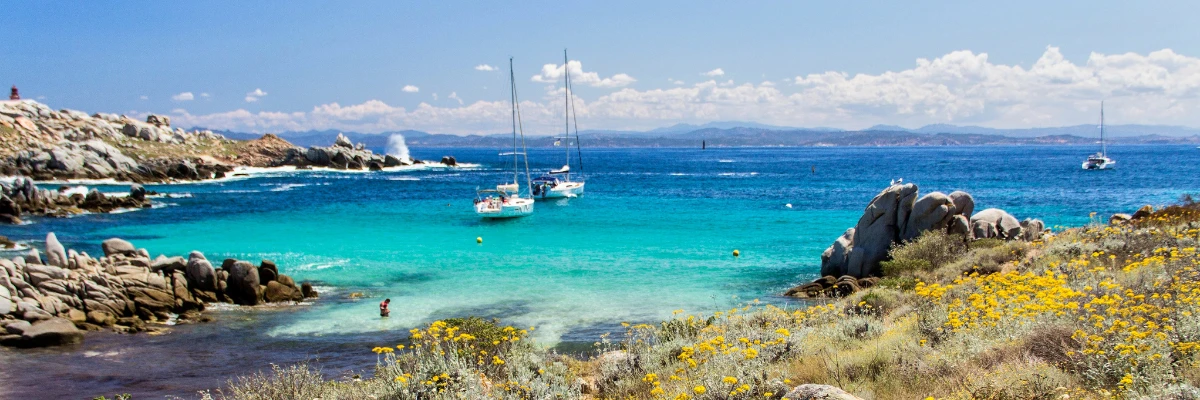
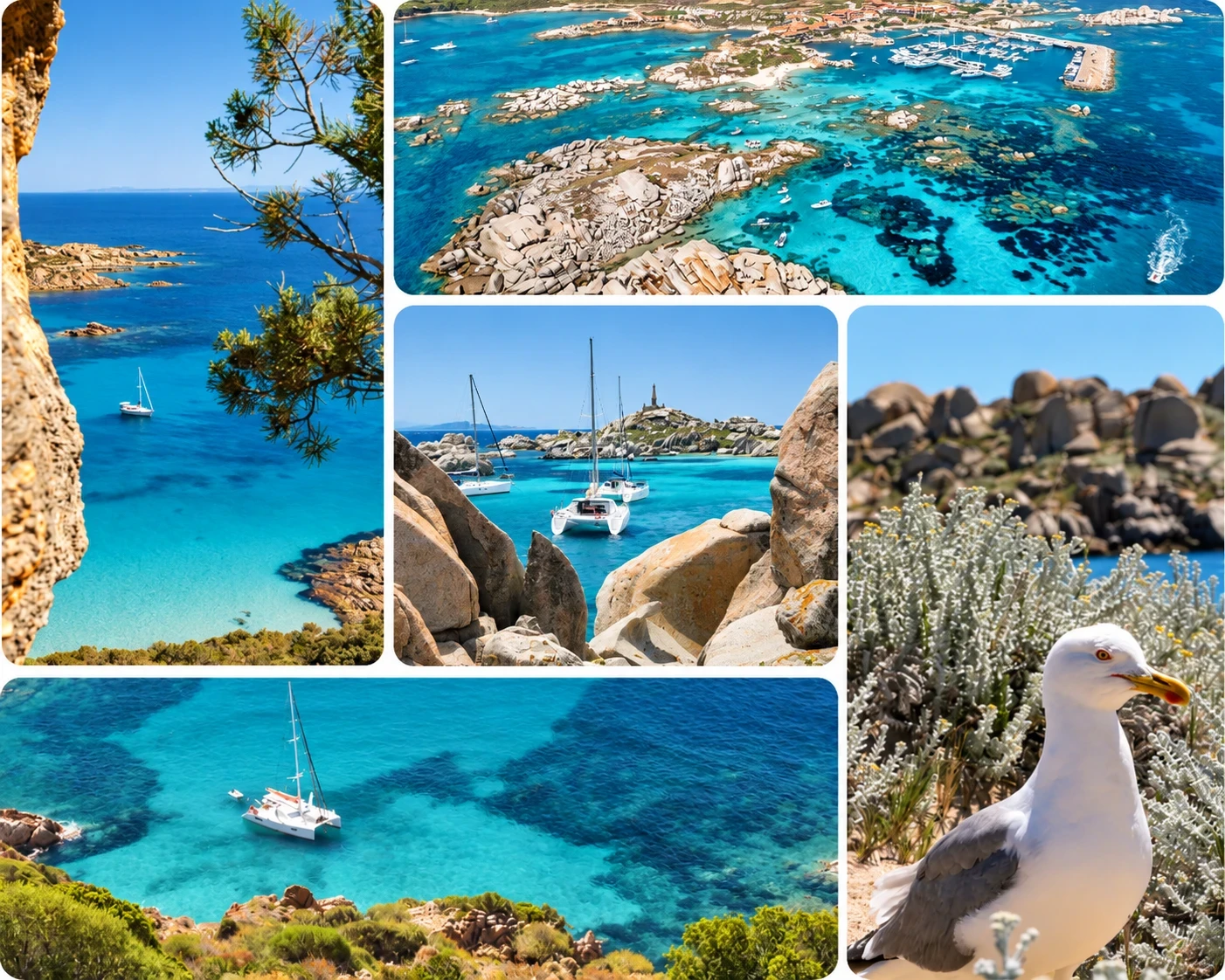
The Lavezzi Islands are a granite archipelago lying around 10 kilometres south-east of Bonifacio, in the middle of the Strait of Bonifacio. No road leads there: you discover them by boat, and that is precisely their charm. Turquoise water, wind-polished granite boulders, white-sand coves: the scenery easily brings the Caribbean to mind. But the archipelago is also a strictly regulated nature reserve, where every anchorage needs planning. Here is everything you need to discover southern Corsica from the sea and enjoy the Lavezzi while respecting the local rules.
'Dropping anchor in 6 metres of water in Cala di Giunco, on the southern side, we are literally moored in a swimming pool, the water is so turquoise and clear,' says François Lillet, back from a week's sailing between Sardinia and the Lavezzi.
The Lavezzi Islands at a glance
The archipelago is made up of 23 islands, islets and reefs between Corsica and Sardinia, in one of the most spectacular stretches of water for Mediterranean sailing. It is home to the southernmost point of mainland France, which makes it an almost unmissable stop on a tour of Corsica by boat. The two main islands are Cavallo, the only inhabited one, and Lavezzu, which gave the archipelago its name.
| Key fact | Detail |
| Location | Approx. 10 km south-east of Bonifacio |
| Make-up | 23 islands, islets and reefs |
| Main islands | Lavezzu, Cavallo |
| Nature reserve | Since 1982 |
| Bouches de Bonifacio reserve | Since 1999 |
| Access | By sea only |
Exceptional natural surroundings
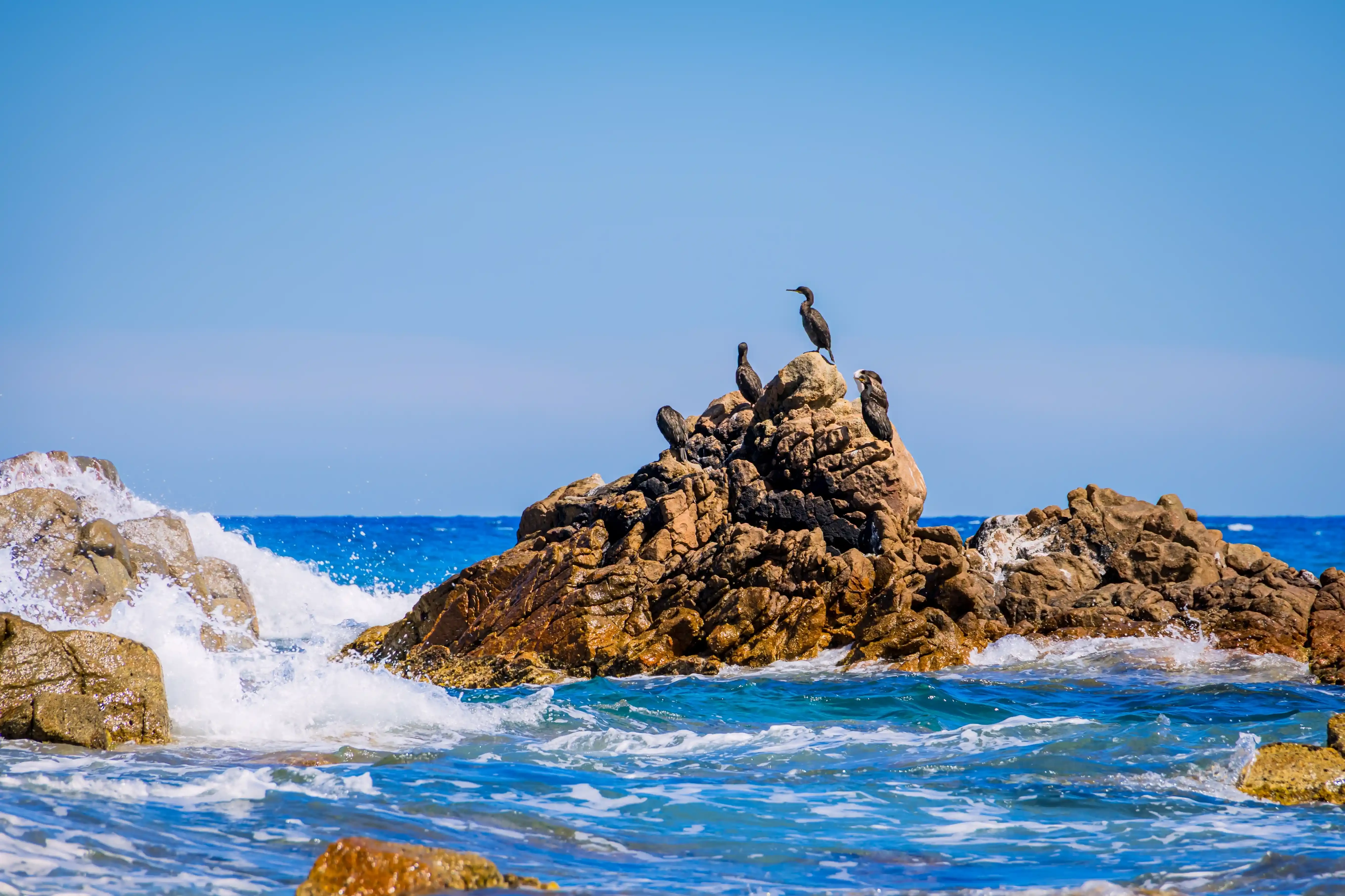
Designated a nature reserve in 1982, the archipelago became part of the Bouches de Bonifacio nature reserve in 1999. Underwater, the Posidonia seagrass meadows serve as a nursery for countless fish. On land, the low scrub gives way to some surprising plants, such as the dead-horse arum and its very distinctive smell. Above all, the Lavezzi are a vital refuge for seabirds: the Mediterranean shag and Audouin's gull, two threatened species, find resting and nesting sites here.
Getting to the Lavezzi Islands by boat
Which port should you set off from?
Bonifacio is the natural gateway to the archipelago: the Lavezzi are just 5 or 6 nautical miles from its harbour, a short passage. From Porto-Vecchio, allow around 15 nautical miles following the coast south, with some lovely stops possible along the way. Catamaran hire in Corsica remains the most comfortable option for the archipelago: shallow draught, stability at anchor and a large platform for swimming.
The archipelago is just as easy to reach from Italy. Santa Teresa di Gallura, on the northern tip of Sardinia, faces Bonifacio across the strait: the Lavezzi are therefore a classic stop for anyone cruising the north of Sardinia.
Wind and sailing in the Strait of Bonifacio
The Strait of Bonifacio has a reputation as one of the windiest passages in the Mediterranean. Squeezed between Corsica and Sardinia, the strait accelerates the westerly wind and quickly builds a short, steep sea. If you are arriving along the west coast, wind strength and sea state have a direct impact on how long the passage from Propriano to Bonifacio takes. The approaches to the archipelago are also scattered with half-submerged rocks and shallows. Check the forecast before every outing, keep your chart up to date and approach anchorages at low speed, with a crew member on the bow.
The best time to go
In July and August, the anchorages are packed during the day with yachts and day-trip boats from Bonifacio. Reserve wardens then direct boats to the authorised areas. June and September offer the best compromise: water that is still warm, settled weather and much quieter coves. It is also a quieter time for boat hire in Bonifacio, once the harbour has settled down again. Whatever the season, late afternoon and early morning remain the most peaceful times. At Filovent, where we have been organising sailing holidays since 1995, we recommend leaving Bonifacio early in the morning to find a spot in the buoyed areas, and keeping a back-up cove in mind in case the first one is full.
Reserve regulations
Sailing around the Lavezzi Islands remains open to all, but within a precise framework set by the maritime prefecture. The rules can change depending on the season, the area and the size of the boat: always check the regulations in force and the buoyage plan before setting off.
These rules apply to every boat, whatever your qualifications. For bareboat charter, companies in France usually ask British skippers for an ICC (International Certificate of Competence) or an equivalent RYA qualification, together with a sailing CV: check the exact requirements for your boat before booking.
Anchoring
- Anchoring is only permitted in the areas marked out in season, for boats under 24 metres.
- Outside these areas, anchoring is only allowed in depths of more than 40 metres.
- In Cala Lazarina, some sectors are reserved for boats under 15 metres.
- Several sectors, north of Lavezzu and around the islets of Ratino, Porraggia and Perduto, are closed to navigation, anchoring and stopping to protect the birds.
- Yellow buoys mark the boundaries of the areas: mooring to them is prohibited.
Approaching the shore and landing
- Within the 300-metre coastal strip, access channels may only be used in transit, at a maximum of 5 knots.
- Landing is permitted on Lavezzu, provided you stay on the marked paths.
- Dogs are banned on the islands, as are camping and bivouacking.
Fishing and diving
- Recreational fishing in the reserve must be declared and is banned in no-take zones.
- Spearfishing is banned in the enhanced protection zones.
- Scuba diving is banned in certain sensitive sectors; snorkelling is still possible from the authorised anchorages.
Anchorages in the Lavezzi Islands
Lavezzu has the finest anchorages in the archipelago, while Cavallo adds two large bays. On Lavezzu, each anchorage has a defined area: look out for the yellow buoys as you arrive and stay inside them.
| Anchorage | Island | Shelter | Seabed | Good to know |
| Cala Lazarina | Lavezzu | Easterly and westerly winds | Sand, 3 to 5 m | Open to the south, very busy in summer |
| Cala di Chiesa | Lavezzu | Easterly and southerly winds | 3 to 8 m | Tricky entrance, many rocks |
| Cala di U Ghiuncu | Lavezzu | Depends on buoyed area | See chart | Easy access |
| Cala di Zeri | Cavallo | Depends on the day's wind | Sand, 3 to 7 m | Rocks awash in the middle |
| Cala di Palma | Cavallo | Westerly wind | 3 to 4 m | Untenable in an easterly |
Cala Lazarina
Cala Lazarina is the best-known anchorage in the Lavezzi. On the south side of Lavezzu, the cove opens onto a fine sandy beach framed by granite boulders. The sandy bottom offers good holding, but a few rocks break the surface at the entrance. Sheltered from both easterly and westerly winds, it remains open to the south. Just a short walk away, the Sémillante pyramid commemorates the shipwreck of 1855.
Cala di Chiesa
On the north-west side of the island, this narrow cove is tucked between tall granite boulders. With water this clear and a rocky seabed teeming with fish, it is a favourite with snorkellers. The approach does call for caution, though: there are plenty of rocks and space is limited. In high season, arrive early.
Cala di U Ghiuncu
Also known as Cala di Giunco, this anchorage lies in the south of Lavezzu, facing one of the Sémillante cemeteries, and wins you over with its easy access. Less spectacular than its neighbours, it makes a good fallback when the other coves are full. It is also a popular stop for crews setting out from Santa Teresa di Gallura on a sailing tour of Sardinia.
Cavallo, the archipelago's private island
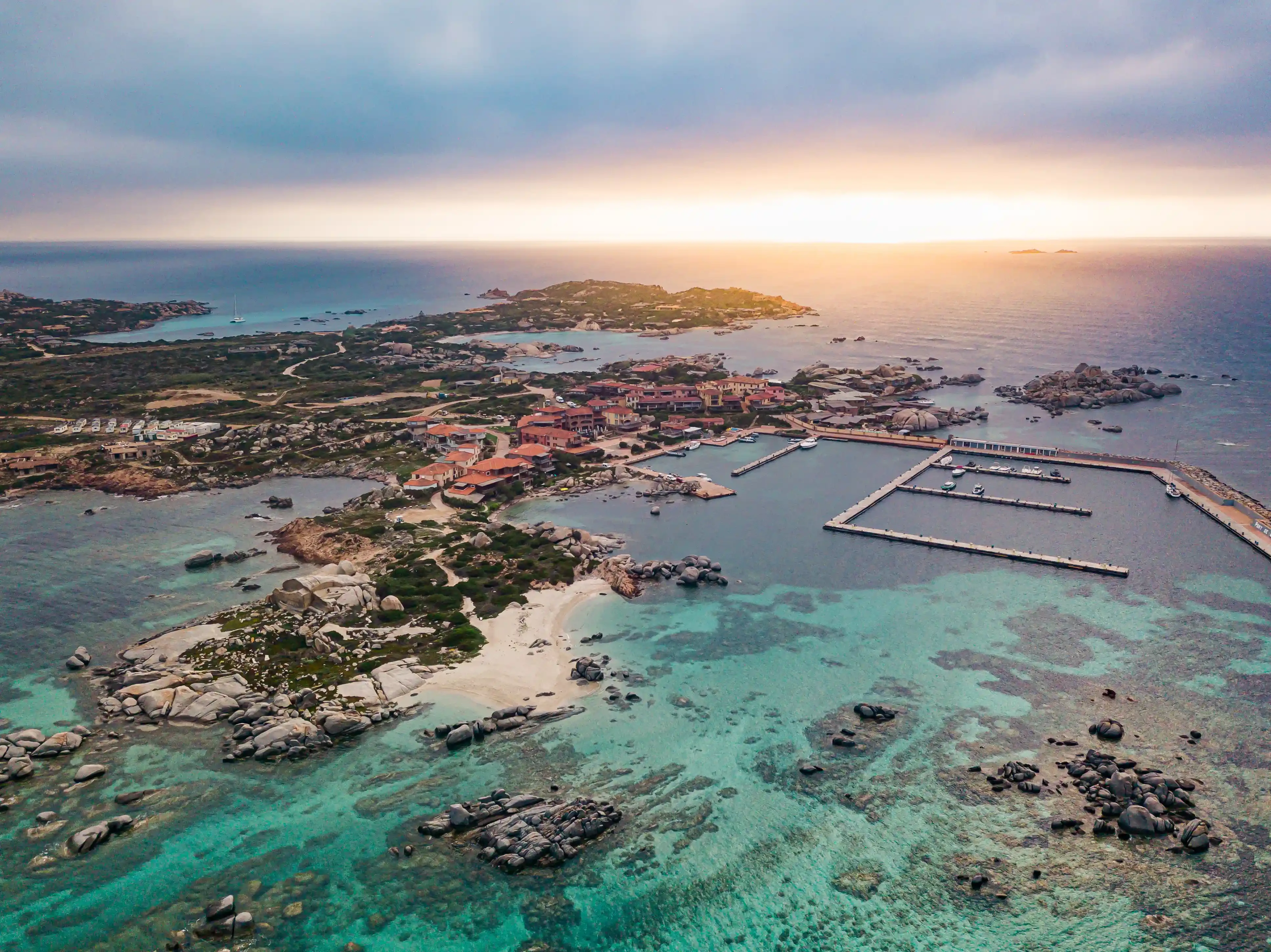
The largest of the Lavezzi and the only one inhabited, Cavallo is mainly home to discreet villas, a hotel and a small marina open in summer. The interior of the island is private, but the shoreline belongs to the public maritime domain: from a boat, nothing stops you cruising along its coast and swimming in its coves. Several sectors, however, are closed to anchoring to protect the seagrass meadows.
Cala di Zeri
This is the most practical anchorage on Cavallo. The bay is wide and the sandy bottom offers good holding. Rocks break the surface in the middle: keep to the right as you enter and anchor on sand.
Cala di Palma
This large white-sand bay offers a lovely view over the archipelago and across to Sardinia, just a few nautical miles away. The bay is an easy day trip from Santa Teresa di Gallura or Palau with catamaran hire in Sardinia. Usable in a westerly, it becomes untenable as soon as the wind veers east. The seabed near the shore is poorly charted: best keep it for a daytime stop in calm weather.
What to do in the Lavezzi Islands?
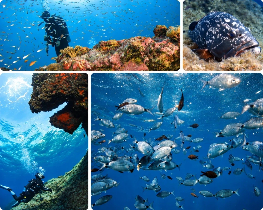
- Snorkelling: in the protected waters of the reserve, shoals of sea bream and salema are everywhere, and groupers sometimes let you get close.
- Walking on Lavezzu: the marked paths wind between sculpted rocks and lead to the best viewpoints.
- Remembering the Sémillante: on 15 February 1855, this frigate, which had left Toulon for the Crimean War, was wrecked on the reefs of Lavezzu, with no survivors among the roughly 700 people on board. Two cemeteries and a stone pyramid honour their memory.
- Birdwatching: shags, Audouin's gulls and shearwaters, to be observed from a distance, binoculars in hand.
For a first visit, allow at least a full day around the archipelago, ideally two to combine Lavezzu, Cavallo and a quiet night at anchor. To plan your route through the strait, you can also hire a sailing boat in Corsica.
Frequently asked questions
Where are the Lavezzi Islands?
At the far southern tip of Corsica, in the Strait of Bonifacio, around 10 km south-east of Bonifacio. The archipelago is home to the southernmost point of mainland France.
Can you anchor anywhere in the Lavezzi Islands?
No. Anchoring is restricted to the areas buoyed in season, for boats under 24 metres, or to depths of more than 40 metres. Some sectors are completely closed to navigation.
Can you go ashore on the islands?
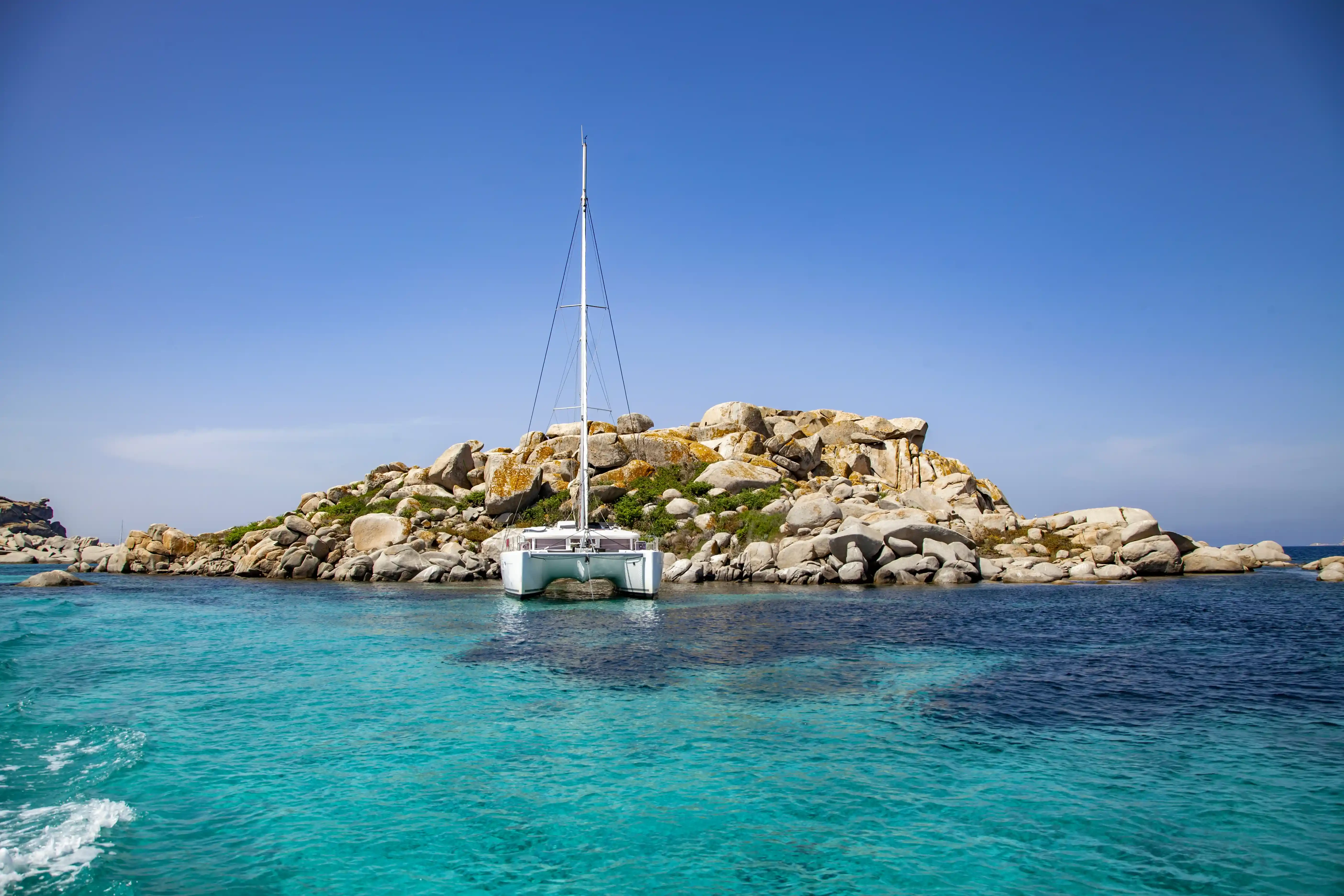
Yes, on Lavezzu, as long as you stay on the marked paths. Dogs, camping and bivouacking are banned. On Cavallo, the interior of the island is private.
When is the best time to sail to the Lavezzi Islands?
June and September are the most pleasant months: settled weather, warm water and moderate crowds. July and August are very busy at the anchorages.
Can you fish in the Lavezzi Islands?
Recreational fishing is allowed in some areas, subject to prior declaration. It is banned in no-take zones, and spearfishing is banned in the enhanced protection zones.
Sources
- Décret du 23 septembre 1999 portant création de la réserve naturelle des Bouches de Bonifacio (département de la Corse-du-Sud). (1999). Journal officiel de la République française. https://www.legifrance.gouv.fr/jorf/id/JORFTEXT000000212517
- Le Figaro Nautisme. (2026, 2 June). Navigation dans les Bouches de Bonifacio : les règles à connaître avant de prendre la mer. https://figaronautisme.meteoconsult.fr/actus-nautisme-escales/2026-06-02/88793-navigation-dans-les-bouches-de-bonifacio-les-regles-a-connaitre-avant-de-prendre-la-mer
- Le Figaro Nautisme. (2026, 19 April). Îles Lavezzi : 4 zones interdites à la navigation et au mouillage pour protéger les oiseaux marins. https://figaronautisme.meteoconsult.fr/actus-nautisme-escales/2026-04-19/87497-iles-lavezzi-4-zones-interdites-a-la-navigation-et-au-mouillage-pour-proteger-les-oiseaux-marins
- Office de l'environnement de la Corse. (n.d.). Réserve naturelle des Bouches de Bonifacio [Leaflet]. https://www.oec.corsica/attachment/700562/
- Sites & Monuments. (n.d.). Bonifacio : restauration des cimetières des îles Lavezzi. https://www.sitesetmonuments.org/restauration-des-cimetieres-des-iles-lavezzi
- Sea-Seek. (n.d.). Cala della Chiesa (Lavezzi). https://www.sea-seek.com/fr/Cala-della-Chiesa-Lavezzi-
- Sea-Seek. (n.d.). Cala di Zeri (Cavallo). https://www.sea-seek.com/fr/Cala-di-Zeri-Cavallo-
- Wikipédia. (n.d.). Îles Lavezzi. https://fr.wikipedia.org/wiki/%C3%8Eles_Lavezzi